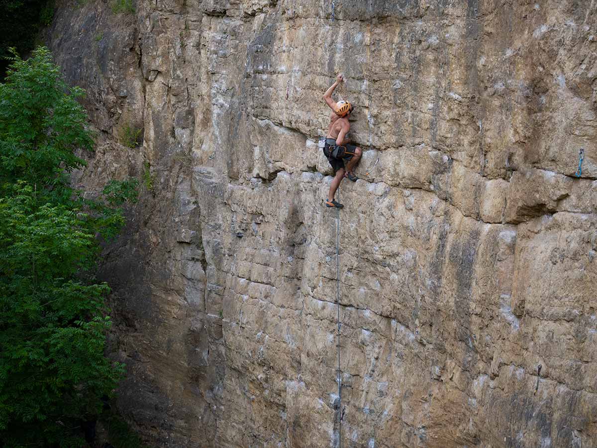
The upper section of Reliquary, a popular 7a+ in the centre of Stemple Wall
General
The climbing style is unlike other climbing in this area and more like the climbing in some of the Matlock quarries. The yellow rock varies from a rough surface veneer to the extremely smooth frictionless underlayer.
Deep Rake is often a victim of it’s own success. The combination of close proximity to Sheffield, good climbing, soft grades and lots of bolts makes it a very popular venue, but with only a dozen routes on the main wall it doesn’t take many people to make it feel crowded. You can get an idea of how busy it will be by noting the number of cars in the parking area before walking up to the crag.
Aspect
The main wall (Stemple Wall) faces south and goes into the shade by 6pm at mid-summer. Hanging wall faces north so is shady all day. The crag dries out quickly after rain. The crag gets no sun in winter and can remain damp after sufficient rain. The crag can be sheltered from breezy weather though stronger winds from the wrong direction can still make the place quite chilly.
Approaches
Low Carbon options
The nearest railway station is Grindleford which is 6.2km away or 20 mins by bike from the crag.
Leave the station and turn right (south) on Station Road. After 500m join the B6521 (New Road). Cross over the Derwent river and carry on through Grindleford. Follow this road through the crossroads at Calver and carry on for another 1.3km to Bramley Lane on the left. The path to the crag is on the opposite side of the road and leads up the hillside and on to the crag after 700m.
You can get a bus to Calver and walk down the road (1.3km) to the path opposite Bramley Lane.
Check bus services and times for Calver.
By car
From the Calver crossroads drive south on the B6001 towards Hassop. After 1km you reach the brow of the hill where there is parking on the left side of the road at a vague cross roads.
Go up the track on the opposite side of the road for about 500m (10 mins) until the top of the quarry can be seen peaking out across the fields on the left. Go through gates and across to some footpegs on the northeast fence post to allow you to cross without weighting the wire. A fixed rope leads down to the base of the quarry. This is the only parking you should use. The crag should no longer be approached from the road through Rowland since this will cause access problems.